Volcano Season Update:
12/16/14
The ongoing #quakeswarm near Lakeview, Oregon on the Nevada border continues to quietly rage on with no let up in more than 2 months. Yellowstone continues to "Burp" SO2 and Methane, Mt Shasta sheds glaciers, and Mt Saint Helens #MagmaChamber is Re-Charging. With the continued uptick in Global Volcanism and stronger Seismic events on the increase,
When we will see a significant eruption in the Inter Mountain West?
The previously thought to be Dormant Cascadia Fault Zone is poised for a Major Slippage event. We here at MP are not Seismologists, Volcanologists or Climate Scientists.We can see a Trend and it shows that we are in the middle of what some have deemed #VolcanoSeason. We are not Predicting an Earthquake or Eruption, yet, Be Prepared for Seismic events if you live near one of these areas. _MP
16.12.2014
Current reports from the area in the corner of Nevada shows over 120 #quakes in the last 7 Days. The temblors have been growing steadily stronger with time. Six earthquakes of magnitude 4.0 or greater have struck the area since Tuesday and about 40 have struck in the last 24 hours, This week it has just gone crazy
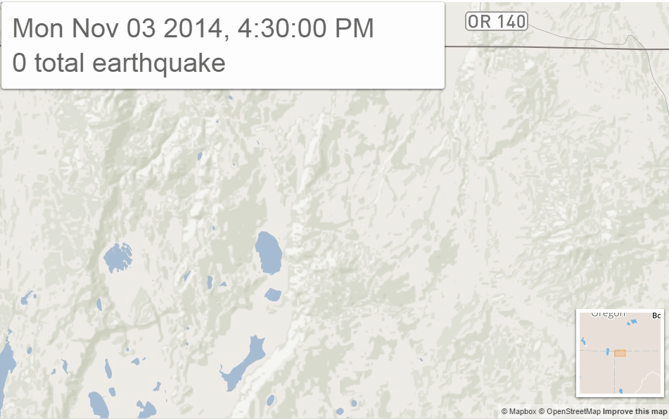
07.11.2014
The swarm is beneath an uninhabited part of the Nevada desert near the Sheldon National Wildlife Refuge, but officials are telling the public, especially the almost 2,300 residents of Lakeview, to develop earthquake plans if they haven't already.
"If you are not ready for an earthquake, now is an awfully good time to get ready for an earthquake," said Alison Ryan, a spokeswoman for the department. - LATimes.com
Check this page out for more info on Quake Prediction Models:http://dutchsinse.com/12152014-how-to-forecast-an-earthquake/
#QuakeSwarm near #Lakeview OR has experts stressing #Earthquake Preparedness -#VolcanoSeason http://t.co/9cNVfG0eO2 #Cascadia #Yellowstone
— Madtown Preppers (@MadtownPreppers) December 16, 2014
Northeast California and Nevada Dealing With Swarm Of Earthquakes
 |
| About 750 earthquakes, mostly magnitude 2.0 to 3.0, have struck the area about 50 miles southeast of Lakeview, Ore., since the swarm started in July, said Ian Madin, chief scientist for Oregon's Department of Geology and Mineral Industries. "This week it has just gone crazy," Madin said. - LATimes.com |
November 7, 2014
By JAVIER PANZAR Earthquakes
A swarm of hundreds of earthquakes that has been striking a corner of the Nevada desert near the Oregon border for months has intensified in recent days, prompting new warnings from seismologists.
About 750 earthquakes, mostly magnitude 2.0 to 3.0, have struck the area about 50 miles southeast of Lakeview, Ore., since the swarm started in July, said Ian Madin, chief scientist for Oregon's Department of Geology and Mineral Industries.
The temblors have been growing steadily stronger with time. Six earthquakes of magnitude 4.0 or greater have struck the area since Tuesday and about 40 have struck in the last 24 hours, Madin said.
"This week it has just gone crazy," Madin said.
The swarm is beneath an uninhabited part of the Nevada desert near the Sheldon National Wildlife Refuge, but officials are telling the public, especially the almost 2,300 residents of Lakeview, to develop earthquake plans if they haven't already.
"If you are not ready for an earthquake, now is an awfully good time to get ready for an earthquake," said Alison Ryan, a spokeswoman for the department.
Scientists believe groundwater is slowly percolating along the faults and building up pressure, making movement on the faults much easier, said John Vidale, director of the Pacific Northwest Seismic Network at the University of Washington.
"It doesn't necessarily mean anything big is coming, but it does raise the risk there will be a bigger quake in the future," he said. "Ninety-nine percent of the time nothing too dramatic happens, but every now and then there is a good pop and everyone asks why we didn't predict it."
Read more:
http://www.latimes.com/nation/nationnow/la-na-nn-swarm-earthquakes-oregon-nevada-20141107-htmlstory.html
Our Top post of 2014:#VolcanoSeason #Yellowstone and Sulphur Dioxide Release http://madtownpreppers.blogspot.com/2014/10/yellowstone-update-major-sulphur.html Madtown Preppers on FB
A NEW #quake / #Volcano post coming up discussing the Lakeview OR/NV #quakeswarm and the Cascadia fault
twitter.com/MadtownPreppers
 |
| The map above shows the trail the calderas as the continent has moved over the hot spot. |
Mapping, geologic evolution and petrogenesis of the McDermitt caldera center, northern Nevada & southern Oregon, USA
Starkel, William AustinURI: http://hdl.handle.net/2376/5162
Date: 2014
Keywords:
Petrology, Geochemistry, Geology, basalt, calderas, hotspot, intermediate, magma evolution, rhyolite
Abstract:
The McDermitt caldera center ("McDermitt") is a polygenetic mid-Miocene volcanic center along the border of northern Nevada and southern Oregon, USA, and is one of the first silicic centers associated with the Yellowstone hotspot. McDermitt was active during the main stage of the voluminous Columbia River Basalt Group eruptions, and Steens Basalt forms the base of the Miocene volcanic section. Magmatism climaxed with the caldera-forming eruption of the ~ 400 km3 compositionally variable McDermitt Tuff at 16.35 ± 0.03 Ma. Geologic mapping of the western caldera margin has revealed much information on the evolution of the McDermitt caldera center and insight to the mechanics of the caldera-forming eruption. Geochemical investigations of the mafic volcanics at McDermitt reveals important links between local mafic magmas and the Steens Basalts, and thus to the Columbia River Basalts. A small group of compositionally distinct basalts at McDermitt have the most oceanic chemical signatures yet found among basalts of the Yellowstone hotpsot, which bears on the plume versus non-plume argument for the Yellowstone hotspot. Petrologic investigations and modeling of the silicic magmas reveal AFC process as the dominant magma evolution mechanism for the rhyolites at McDermitt, but some deviations exist (e.g., abundant assimilation, partial melting of cumulates crystallized from the magma). The results of this study are consistent with a model where Steens source magmas underplated Cretaceous intrusions as a result of mantle upwelling from the Yellowstone hotspot. These mafic magmas assimilated the country rock, and coupled with fractionation, evolved to a suite of intermediate magmas. The intermediate magmas subsequently evolved, through AFC and other evolutionary pathways, to form the rhyolites at McDermitt.
10/30/2014 — TWO 4.2M EARTHQUAKES + SWARM STRIKE NORTHERN NEVADA — OLD VOLCANIC FISSURE
OCTOBER 30, 2014 MICHAEL JANITCH
Activity begin to develop at this location back in August of this year (2014):

October 21st, 2014 earthquake activity returned to Nevada near a series of dormant volcanoes:


Special maps: Yellowstone National Park || ANSS Intermountain West Region
Map need updating? Try reloading the page to your browser.
Maps are updated within about 5 minutes of an earthquake or once an hour.
Brown lines represent known hazardous faults or fault zones. White lines are roads.
What happens when I click on an earthquake?
Update time = Tue Dec 16 14:00:12 MST 2014
Here are the 30 most recent earthquakes and all M>3 earthquakes on this map...
Here are the 30 most recent earthquakes and all M>3 earthquakes on this map...
 MAG    DATE    LOCAL-TIME  LAT     LON    DEPTH    LOCATION
        y/m/d     h:m:s     deg     deg     km
1.8 2014/12/16 13:08:51 37.625N 115.891W 0.0 23 km (14 mi) W of Tempiute, NV
1.4 2014/12/16 12:29:38 44.320N 110.607W 2.1 55 km (34 mi) SE of West Yellowstone, MT
2.3 2014/12/16 06:45:49 38.968N 111.403W -1.4 14 km ( 9 mi) WNW of Emery, UT
1.6 2014/12/16 05:33:10 38.967N 111.406W 3.2 14 km ( 9 mi) WNW of Emery, UT
2.0 2014/12/16 03:22:20 41.863N 119.609W 4.4 12 km ( 8 mi) NE of Wimer Place, NV
2.8 2014/12/16 03:17:24 41.866N 119.605W 1.7 13 km ( 8 mi) NE of Wimer Place, NV
0.4 2014/12/16 02:05:15 36.885N 116.022W 2.5 47 km (29 mi) NW of Indian Springs, NV
2.0 2014/12/16 01:58:36 41.838N 119.633W 2.6 9 km ( 5 mi) ENE of Wimer Place, NV
1.7 2014/12/16 01:46:51 37.125N 117.215W 10.6 15 km ( 9 mi) NE of Scottys Castle, CA
1.8 2014/12/16 00:45:08 41.868N 119.613W 3.8 12 km ( 8 mi) NE of Wimer Place, NV
1.8 2014/12/16 00:37:05 41.854N 119.606W 2.9 12 km ( 7 mi) ENE of Wimer Place, NV
1.8 2014/12/15 23:06:33 41.874N 119.616W 4.9 12 km ( 8 mi) NE of Wimer Place, NV
1.4 2014/12/15 21:36:14 41.824N 119.654W 1.2 7 km ( 4 mi) ENE of Wimer Place, NV
1.3 2014/12/15 21:23:18 38.966N 111.401W 3.1 14 km ( 9 mi) WNW of Emery, UT
2.2 2014/12/15 19:35:46 41.847N 119.632W 1.6 9 km ( 6 mi) NE of Wimer Place, NV
2.0 2014/12/15 18:30:00 41.870N 119.604W 0.8 13 km ( 8 mi) NE of Wimer Place, NV
1.5 2014/12/15 17:51:07 36.884N 116.005W 5.5 45 km (28 mi) NW of Indian Springs, NV
2.8 2014/12/15 16:09:05 41.861N 119.606W 3.6 12 km ( 7 mi) NE of Wimer Place, NV
2.3 2014/12/15 16:00:50 41.670N 111.686W 7.6 11 km ( 7 mi) E of Millville, UT
0.8 2014/12/15 15:39:22 41.509N 112.301W 10.5 16 km (10 mi) WSW of Corinne, UT
2.1 2014/12/15 14:25:19 38.962N 111.386W 1.7 13 km ( 8 mi) WNW of Emery, UT
2.1 2014/12/15 14:01:21 41.824N 119.622W 3.5 9 km ( 6 mi) ENE of Wimer Place, NV
0.7 2014/12/15 13:38:20 41.510N 112.341W 1.7 19 km (12 mi) WSW of Corinne, UT
2.5 2014/12/15 13:31:59 41.512N 112.330W 5.2 18 km (11 mi) WSW of Corinne, UT
2.6 2014/12/15 13:00:13 41.866N 119.620W 5.5 12 km ( 7 mi) NE of Wimer Place, NV
1.6 2014/12/15 12:24:31 38.963N 111.391W 1.7 13 km ( 8 mi) WNW of Emery, UT
0.2 2014/12/15 12:18:00 36.724N 116.123W 0.4 43 km (27 mi) WNW of Indian Springs, NV
2.8 2014/12/15 12:01:41 41.832N 119.627W 2.5 9 km ( 6 mi) ENE of Wimer Place, NV
2.1 2014/12/15 11:43:05 41.892N 119.618W 9.5 14 km ( 9 mi) NE of Wimer Place, NV
2.4 2014/12/15 11:02:25 44.252N 110.760W 4.4 47 km (29 mi) ENE of Warm River, ID
3.6 2014/12/15 07:46:03 41.865N 119.594W 2.2 13 km ( 8 mi) NE of Wimer Place, NV
3.3 2014/12/14 15:58:02 41.885N 119.611W 4.2 13 km ( 8 mi) NE of Wimer Place, NV
3.8 2014/12/14 10:26:51 41.898N 119.622W 6.4 14 km ( 9 mi) NE of Wimer Place, NV
3.3 2014/12/14 02:28:23 41.864N 119.600W 3.1 13 km ( 8 mi) NE of Wimer Place, NV
3.0 2014/12/12 14:36:45 41.909N 119.628W 10.5 15 km ( 9 mi) NNE of Wimer Place, NV
3.8 2014/12/10 17:06:29 41.855N 119.612W 6.4 11 km ( 7 mi) NE of Wimer Place, NV
3.7 2014/12/10 15:46:20 41.861N 119.631W 5.9 10 km ( 7 mi) NE of Wimer Place, NV
3.2 2014/12/10 07:22:49 41.835N 119.608W 3.8 11 km ( 7 mi) ENE of Wimer Place, NV
3.4 2014/12/10 07:07:29 41.850N 119.602W 5.0 12 km ( 7 mi) ENE of Wimer Place, NV
3.3 2014/12/10 06:53:43 41.833N 119.622W 4.5 9 km ( 6 mi) ENE of Wimer Place, NV
3.4 2014/12/10 06:52:33 41.845N 119.608W 3.4 11 km ( 7 mi) ENE of Wimer Place, NV
4.2 2014/12/10 06:50:58 41.840N 119.613W 5.2 10 km ( 6 mi) ENE of Wimer Place, NV
Mount Saint Helens magma chamber recharging:

Yellowstone confirmed rising fast:
#CascadiaFault #OregonQuakeSwarm
Source Report:
https://www.youtube.com/watch?v=OUO623dlSOY&feature=youtu.behttp://www.seis.utah.edu/req2webdir/recenteqs/Maps/anss_imw.html
http://www.thenakedscientists.com/forum/index.php?topic=17940.0
https://www.facebook.com/MadtownPreppers/posts/575296822601831
http://madtownpreppers.blogspot.com/2014/10/volcano-season-increased-volcanism.html
http://dutchsinse.com/10302014-two-4-2m-earthquakes-swarm-strike-northern-nevada-old-volcanic-fissure/
https://research.wsulibs.wsu.edu:8443/xmlui/handle/2376/5162
http://madtownpreppers.blogspot.com/2014/10/volcano-season-increased-volcanism.html#sthash.brTbMDyd.dpuf
http://dutchsinse.com/9202014-global-earthquake-update-unrest-showing-across-multiple-regions/
http://www.ebay.com/cln/nebshipshop
 |
| Be Prepared for Biological Outbreaks with a Pandemic Influenza #QuickKit +NebShip Shop |


 | |
| fb: Madtown Preppers Page +Madtown Preppers @MadtownPreppers |

Madtown Preppers Alerts are for informational use only. These alerts purpose is to inform you of news events in order for you to adjust your family preparedness programs. We believe that knowledge is power and in order for you to make informed decisions, we try and bring you verified information, not to increase fear but to inform you. We do not endorse any of the sources we link to in any article.

NebShip Shop
Survival/Preparedness and Off Grid Living
http://www.ebay.com/sch/nebshipshop/m.html?_nkw=&_armrs=1&_ipg=&_from=
No comments:
Post a Comment