
M2.4 - ILLINOIS
This webpage is being phased out and is no longer maintained. Please use the new Real-time Earthquake Map instead and update your bookmark. See Quick Tips & User Guide.
2013 January 20 04:48:29 UTC
 |
| http://www.ok.gov/OEM/Programs_&_Services/Preparedness/Preparedness_-_Earthquakes.html |


Earthquake Details
- This event has been reviewed by a seismologist.
| Magnitude | 2.4 |
|---|---|
| Date-Time |
|
| Location | 38.333°N, 90.329°W |
| Depth | 0.1 km (~0.1 mile) (poorly constrained) |
| Region | ILLINOIS |
| Distances |
|
| Location Uncertainty | horizontal +/- 0.8 km (0.5 miles); depth +/- 2.8 km (1.7 miles) |
| Parameters | NST= 16, Nph= 21, Dmin=22 km, Rmss=0.22 sec, Gp= 47°, M-type="Nuttli" surface wave magnitude (mbLg), Version=B |
| Source | |
| Event ID | nm012013a |
- Did you feel it? Report shaking and damage at your location. You can also view a map displaying accumulated data from your report and others.
- Editor's Note: This is Probably the same event.
- Preliminary Earthquake Report
- Cooperative New Madrid Seismic Network
M2.4 - 1km N of Barnhart, Missouri 2013-01-20 04:48:29 UTC


Summary
Location and Magnitude contributed by: New Madrid Seismic Network
General
20 km
20 mi
Powered by Leaflet
Missouri
38.333°N, 90.329°W
Depth: 0.1km (0.1mi)
38.333°N, 90.329°W
Depth: 0.1km (0.1mi)
Event Time
- 2013-01-20 04:48:29 UTC
- 2013-01-19 22:48:29 UTC-06:00 at epicenter
- 2013-01-19 22:48:29 UTC-06:00 system time
Location
38.333°N 90.329°W depth=0.1km (0.1mi)Nearby Cities
- 1km (1mi) N of Barnhart, Missouri
- 8km (5mi) S of Arnold, Missouri
- 14km (9mi) SSW of Oakville, Missouri
- 15km (9mi) N of Festus, Missouri
- 157km (98mi) E of Jefferson City, Missouri
Tectonic Summary
Earthquakes in the Illinois Basin - Ozark Dome Region
 This large region borders the much more seismically active New Madrid
seismic zone on the seismic zone's north and west. The Illinois basin -
Ozark dome region covers parts of Indiana, Kentucky, Illinois,
Missouri, and Arkansas and stretches from Indianapolis and St. Louis
to Memphis. Moderately frequent earthquakes occur at irregular intervals
throughout the region. The largest historical earthquake in the
region (magnitude 5.4) damaged southern Illinois in 1968. Moderately
damaging earthquakes strike somewhere in the region each decade or
two, and smaller earthquakes are felt about once or twice a year. In
addition, geologists have found evidence of eight or more prehistoric
earthquakes over the last 25,000 years that were much larger than any
observed historically in the region.
This large region borders the much more seismically active New Madrid
seismic zone on the seismic zone's north and west. The Illinois basin -
Ozark dome region covers parts of Indiana, Kentucky, Illinois,
Missouri, and Arkansas and stretches from Indianapolis and St. Louis
to Memphis. Moderately frequent earthquakes occur at irregular intervals
throughout the region. The largest historical earthquake in the
region (magnitude 5.4) damaged southern Illinois in 1968. Moderately
damaging earthquakes strike somewhere in the region each decade or
two, and smaller earthquakes are felt about once or twice a year. In
addition, geologists have found evidence of eight or more prehistoric
earthquakes over the last 25,000 years that were much larger than any
observed historically in the region. Earthquakes in the central and eastern U.S., although less frequent than in the western U.S., are typically felt over a much broader region. East of the Rockies, an earthquake can be felt over an area as much as ten times larger than a similar magnitude earthquake on the west coast. A magnitude 4.0 eastern U.S. earthquake typically can be felt at many places as far as 100 km (60 mi) from where it occurred, and it infrequently causes damage near its source. A magnitude 5.5 eastern U.S. earthquake usually can be felt as far as 500 km (300 mi) from where it occurred, and sometimes causes damage as far away as 40 km (25 mi).
Faults
Earthquakes everywhere occur on faults within bedrock, usually miles deep. Most bedrock in the Illinois basin - Ozark dome region was formed as several generations of mountains rose and were eroded down again over the last billion or so years.At well-studied plate boundaries like the San Andreas fault system in California, often scientists can determine the name of the specific fault that is responsible for an earthquake. In contrast, east of the Rocky Mountains this is rarely the case. The Illinois basin - Ozark dome region is far from the nearest plate boundaries, which are in the center of the Atlantic Ocean, in the Caribbean Sea, and in the Gulf of California. The region is laced with known faults but numerous smaller or deeply buried faults remain undetected. Even the known faults are poorly located at earthquake depths. Accordingly, few earthquakes in the region can be linked to named faults. It is difficult to determine if a known fault is still active and could slip and cause an earthquake. As in most other areas east of the Rockies, the best guide to earthquake hazards in the Illinois basin - Ozark dome region is the earthquakes themselves.
Additional Commentary
Felt at Imperial, Pevely and Saint Louis.
Additional Data Contributors
- USGS National Earthquake Information Center
- USGS, NEIC, Golden, Colorado (and predecessors)
Wednesday, December 26, 2012
Seismic Alert: New Madrid Earthquake Swarm - LA Sinkhole - Large area of Gas Bubbling - Information Only - 26.12.2012

Watching some of the non-coverage about the Bayou Corne, LA Sinkhole, We've noticed some Recent Alarming Trends:
- Increasing Out-Gassing and Plume Activity over the Past 2 Weeks
- Increasing Displacement of Seawater, Brackish, and Contaminated Water emerging from Hole
- Increased Seismic Activity in the Area (Non-Fracking Related)
- Increased Seismic Activity near New Madrid Fault Zone
- No News Coverage (not really a Pre-Cursor)
We do not and cannot imply the Prediction or Actual Emergency Announcement.
We are Truth-Seekers and will Watch Signs as they Appear.
We are not Experts "in the field".
Being Prepared for Disasters and Emergencies is a Process.
A Process that involves, Commitment, Planning, Training, and Practice.
Not a Bad Time to Practice with the Recent Storms, Winter and Spring Storm Season coming.
We'll be with You.
-MP
 Recent Earthquakes in Central US
All Earthquakes on Index Map
Disclaimer
Earthquakes recorded for the last six months.
Times are local (CST or CDT).
The most recent earthquakes are at the top of the list.
Click on the word "map" or "MAP" to see a map displaying the earthquake.
Click on an event "DATE" to get additional text information.
Magnitude 3 and greater earthquakes are printed in bold type.
The top three magnitudes greater than or equal to 3 are in red.
    MAG    DATE    LOCAL-TIME  LAT     LON    DEPTH    LOCATION
           y/m/d     h:m:s     deg     deg     km
map 2.4  2013/01/19 22:48:29 38.333N 90.329W  0.1    4 km ( 3 mi) NNW of Valmeyer, IL
map 2.1  2013/01/19 09:14:03 36.012N 83.829W 17.5    9 km ( 6 mi) SW  of Mascot, TN
map 1.6  2013/01/18 15:22:07 36.543N 89.665W  7.9   13 km ( 8 mi) WSW of New Madrid, MO
map 2.0  2013/01/18 12:15:54 35.624N 97.381W  8.5    7 km ( 4 mi) SW  of Arcadia, OK
map 2.1  2013/01/18 12:01:57 35.638N 97.452W  6.0   11 km ( 7 mi) N   of Lake Aluma, OK
map 2.6  2013/01/16 18:53:25 35.538N 97.353W  5.1    8 km ( 5 mi) E   of Lake Aluma, OK
map 1.6  2013/01/16 17:36:32 36.407N 89.525W  8.3    6 km ( 4 mi) NW  of Tiptonville, TN
MAP 3.2  2013/01/16 14:51:43 35.592N 97.356W  5.0    9 km ( 5 mi) SSW of Arcadia, OK
map 2.4  2013/01/16 07:46:38 44.493N 74.066W  5.0   19 km (12 mi) NNE of Saranac Lake, NY
MAP 3.2  2013/01/16 00:26:35 35.623N 97.368W  8.7    6 km ( 4 mi) SW  of Arcadia, OK
map 2.1  2013/01/15 18:39:33 34.776N 85.031W  6.3    6 km ( 4 mi) WNW of Dalton, GA
map 2.2  2013/01/12 01:34:39 45.559N 74.769W 13.9   86 km (53 mi) NNE of Norfolk, NY
map 2.7  2013/01/10 20:28:46 37.714N 88.897W 16.0    3 km ( 2 mi) ESE of Marion, IL
map 1.2  2013/01/09 23:42:23 36.544N 89.596W  8.0    8 km ( 5 mi) SW  of New Madrid, MO
map 2.0  2013/01/09 17:35:06 38.026N 77.986W  5.1    2 km ( 1 mi) E   of Louisa, VA
map 2.9  2013/01/08 17:18:37 35.455N 97.272W  3.0    7 km ( 4 mi) ESE of Lake Aluma, OK
map 2.2  2013/01/08 06:30:55 35.473N 84.389W  9.2    6 km ( 3 mi) SSW of Madisonville, TN
map 2.6  2013/01/07 12:29:13 36.224N 89.436W  6.3    6 km ( 4 mi) SE  of Ridgely, TN
map 1.5  2013/01/06 22:54:02 36.469N 89.493W  5.4   10 km ( 6 mi) N   of Tiptonville, TN
map 2.5  2013/01/06 18:51:46 37.057N 104.644W  5.4   10 km ( 6 mi) SSW of Cokedale, CO
map 2.7  2013/01/06 18:51:44 37.049N 104.540W  5.0    8 km ( 5 mi) S   of Starkville, CO
map 1.8  2013/01/06 15:47:17 35.892N 91.948W  2.1    4 km ( 2 mi) S   of Guion, AR
map 1.5  2013/01/05 22:09:44 36.292N 89.477W  5.9    3 km ( 2 mi) NNE of Ridgely, TN
map 1.5  2013/01/05 08:50:07 36.507N 89.584W  6.8   10 km ( 6 mi) SSW of New Madrid, MO
MAP 3.4  2013/01/03 19:59:20 35.380N 96.515W  5.0   16 km (10 mi) NW  of Bearden, OK
map 2.8  2013/01/01 05:38:13 34.360N 97.585W  5.0   14 km ( 9 mi) SE  of Velma, OK
map 1.3  2012/12/31 11:14:26 35.958N 89.920W  0.1    3 km ( 2 mi) N   of Blytheville, AR
map 2.1  2012/12/31 08:53:54 35.504N 92.448W  3.9   16 km (10 mi) NNW of Damascus, AR
map 1.1  2012/12/31 03:44:20 36.466N 89.496W  5.9   10 km ( 6 mi) NNW of Tiptonville, TN
map 2.1  2012/12/30 00:44:16 35.494N 92.397W  0.1   14 km ( 9 mi) N   of Damascus, AR
map 1.0  2012/12/29 07:36:19 36.181N 89.441W  8.2   10 km ( 6 mi) SSE of Ridgely, TN
map 1.3  2012/12/27 21:10:13 36.173N 89.435W  8.4   11 km ( 7 mi) SSE of Ridgely, TN
map 2.2  2012/12/27 15:43:16 35.449N 92.313W  1.5   11 km ( 7 mi) NW  of Quitman, AR
map 1.8  2012/12/27 02:32:47 35.483N 92.412W  1.3   13 km ( 8 mi) N   of Damascus, AR
map 1.6  2012/12/26 21:51:40 36.555N 89.614W  5.7    8 km ( 5 mi) WSW of New Madrid, MO
map 1.5  2012/12/26 09:27:19 36.553N 89.611W  7.1    8 km ( 5 mi) WSW of New Madrid, MO
map 1.3  2012/12/26 01:35:56 36.553N 89.611W  6.3    8 km ( 5 mi) WSW of New Madrid, MO
map 1.2  2012/12/25 22:10:55 36.556N 89.610W  5.4    8 km ( 5 mi) WSW of New Madrid, MO
map 2.7  2012/12/25 10:46:09 36.999N 104.856W  5.0   26 km (16 mi) SW  of Cokedale, CO
map 1.0  2012/12/24 23:27:23 36.444N 89.532W  8.6    9 km ( 6 mi) NW  of Tiptonville, TN
map 1.8  2012/12/24 18:00:23 36.190N 89.452W  9.5    9 km ( 5 mi) SSE of Ridgely, TN
map 1.4  2012/12/24 16:47:25 36.189N 89.457W  9.2    9 km ( 5 mi) SSE of Ridgely, TN
map 1.5  2012/12/24 16:47:11 36.190N 89.457W  9.2    9 km ( 5 mi) SSE of Ridgely, TN
map 1.4  2012/12/23 22:01:55 36.533N 89.641W  7.1   12 km ( 7 mi) WSW of New Madrid, MO
map 1.4  2012/12/23 08:21:33 34.889N 85.194W 11.5    8 km ( 5 mi) SSW of Indian Springs, GA
map 0.4  2012/12/22 19:12:30 35.495N 84.534W 11.4    2 km ( 1 mi) SSE of Niota, TN
map 1.9  2012/12/22 17:45:26 35.914N 91.936W  3.8    1 km ( 1 mi) SSE of Guion, AR
map 2.6  2012/12/22 11:55:12 31.881N 94.394W  5.0    4 km ( 2 mi) SSW of Timpson, TX
map 2.0  2012/12/21 22:54:47 35.462N 92.286W  4.0   11 km ( 7 mi) NW  of Quitman, AR
Seismic Alert - LA SINK HOLE: Massive Gas & Liquid from hole – UPDATE 26.12.2012
http://madtownpreppers.blogspot.com/2012/11/massive-sinkhole-still-growing-ohio-4.html
EARTHQUAKE SAFETY:
Oklahoma
has had an increased number of earthquakes in recent years, including
the record-breaking 5.6 magnitude earthquake that occurred on Saturday,
November 6, 2011. To stay safe before, during and after an earthquake,
take the following precautions:
Before an earthquake
- Assemble an emergency preparedness kit for home and your vehicle.
- Have a family emergency plan and identify a safe place to take cover, such as under a sturdy table or desk.
- Teach your family how to “Drop, Cover and Hold” during an earthquake.
- Check for hazards inside or outside your home or office. Heavy objects and falling hazards such as bookcases, hanging picture frames and other items can be dangerous if they are unstable and not anchored securely to a wall or the floor.
- Know emergency telephone numbers.
- Contact your insurance agent to review existing policies and to inquire about earthquake insurance
- Sign up for Earthquake Notifications on the USGS site as well as learn about other products and services they offer.
During an earthquake
- “Drop, Cover and Hold” - DROP to the floor; take COVER under a sturdy table or other piece of furniture. If there isn’t a table or desk near you, seek cover against an interior wall and protect your head and neck with your arms. HOLD ON until the shaking stops.
- Stay away from glass or bookshelves, mirrors or other items that could fall.
- If outside: stand in an open area away from underpasses and overpasses, buildings, trees, telephone, and electrical lines.
- If on the road: drive away from underpasses and overpasses; stop in a safe area; stay in your vehicle.
After an earthquake
- Check for injuries and provide first aid if necessary.
- Do a safety check: check for gas, water, downed power lines and shortages. Turn off appropriate utilities, if you shut off the main gas valve do not turn it back on yourself. Wait for the gas company to check for leaks and make repairs.
- Turn on the radio and listen for instructions on safety or recovery actions.
- Use the telephone for emergencies only.
- When safe follow your family emergency plan.
- Be cautious when opening cabinets.
- Stay away from damaged areas.
- Be prepared for aftershocks.
- If you are able to, log onto the USGS site and fill out a “Did you feel it?” form.
For additional information on individual, family and community preparedness you may visit the following websites:
- USGS Earthquake Frequently Asked Questions
- American Red Cross Information on Earthquake Safety & Preparedness
- Central U. S. Earthquake Consortium (CUSEC) Safety Information
- The Weather Channel Earthquake Safety Sheet
- Federal Emergency Management Agency (FEMA)
- Oklahoma Geographic Survey
- http://www.dropcoverholdon.org/
- USA Emergency Broadcasting Network usaebn.org

 http://climateviewer.com/download/now/
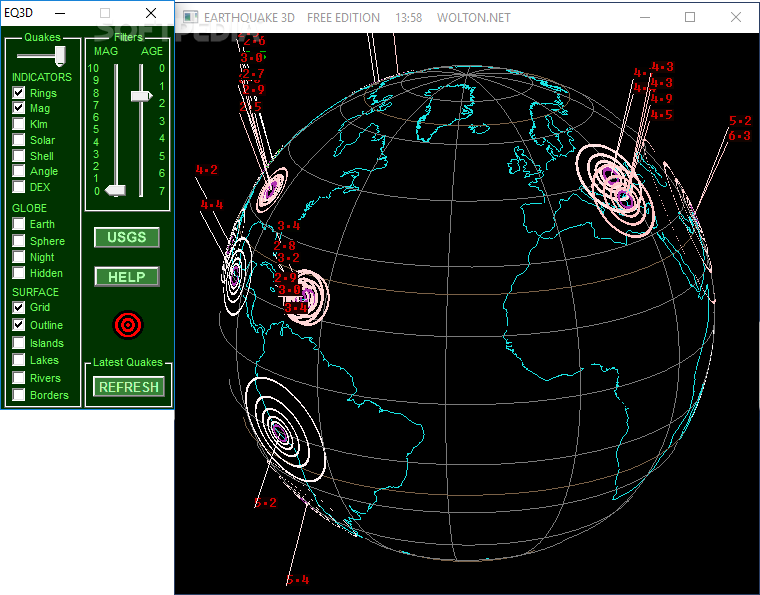 |
| http://download.cnet.com/Earthquake-3D/3000-2054_4-10395116.html |
 |
Madtown Prepper (Situational Preparedness)by USA Emergency Broadcasting Network
in Education
h:391161
s:4257135 archived
Tonight's show is
Madtown Preppers first show on the USA Emergency Broadcasting Network.
We are pleased to welcome him aboard for some very useful infomation on
how to prepare for any disaster we might face.
Tonights show is about Situational Preparedness. Remember Preparedness is a simple as A-B-C Always be informed Build a Kit Create a plan. A wise man prepares for the darkness, while a fool plays. Don’t get caught playing. Listen to USA Emergency Broadcasting Network – An American Readiness Program at usaebn.org In order to save as many lives as we can please pass this information around, link to our site, whatever you need to do to share this information. Together we can save lives. Remember: Research everything before you believe anything!! Recommended For You |
 |
| Madtown Preppers on FB |
No comments:
Post a Comment